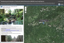
Skip to: Content | Footer | Accessibility
Saturday, May 25, 2013
  search button


Click here to expand contentClick here to collapse content  CalFish Tutorials

CalFish tutorials are available to give you step by step instructions specific to core tools and data that are part of the site.

CALFISH TUTORIAL: Using the Calfish Map Viewer CALFISH TUTORIAL: Using the CalFish Map Viewer (1.9 MB PDF)
The CalFish website provides access to fisheries-related data and maps online. The interactive CalFish Map Viewer allows the public to view the available data spatially, customize map extent, print maps and export tabular results without the need to have GIS software installed on user’s computer.
CALFISH TUTORIAL: California Passage Assessment Database CALFISH TUTORIAL: Reviewing & Editing Passage Assessment Database Records via the CalFish Website (1.5 MB PDF)
Go to the “California Passage Assessment Database” in the “Programs and Projects” section of the CalFish website. Click on “PAD REVIEW TOOL” to open the data review application with a statewide map. The statewide view does not display the PAD records. As the user zooms in to a smaller scale, PAD records categorized by structure type and passage status will appear together with a more detail quad map.
CALFISH TUTORIAL: CalFish as a Resource for Implementing the Draft South-Central California Steelhead Recovery Plan CALFISH TUTORIAL: CalFish as a Resource for Implementing the Draft South-Central California Steelhead Recovery Plan (1.1 MB PDF)
The Recovery Plan identifies threat sources that must be addressed and recovery actions to be taken to meet the plan's goal of preventing the extinction of south-central California steelhead. CalFish provides access to many different types of data that will help to understand and assess threat sources and plan recovery actions. A detailed description of these data and how to best use them is given in the tutorial document.
CALFISH TUTORIAL: CalFish as a Resource for Implementing the Southern California Steelhead Recovery Plan CALFISH TUTORIAL: CalFish as a Resource for Implementing the Southern California Steelhead Recovery Plan (0.5 MB PDF)
The Recovery Plan identifies threat sources that must be addressed and recovery actions to be taken to meet the plan's goal of preventing the extinction of southern California steelhead. CalFish provides access to many different types of data that will help to understand and assess threat sources and plan recovery actions. A detailed description of these data and how to best use them is given in the tutorial document.
Click here to expand contentClick here to collapse content  Map Viewer Bookmarks

CalFish bookmarks are links to instances of the CalFish map viewer preloaded with specific collections of data grouped to offer information to help answer several common fisheries restoration related questions. The bookmarks load at a statewide extent but can be zoomed into a location of interest. Each bookmark is paired with a tutorial that describes the datasets included in the bookmark and how this data can be used to answer the specific question of interest in an example area.

MAP VIEWER BOOKMARK: What Data Does CalFish Offer to Assess Locations of Monitoring Occurring in My Area of Interest? MAP VIEWER BOOKMARK: What Data Does CalFish Offer to Assess Locations of Monitoring Occurring in My Area of Interest?
Opens a statewide map preloaded with salmonid monitoring datasets. The dynamic map can be zoomed to a specific area of interest.

CALFISH TUTORIAL: Using the Locations of Monitoring Bookmark to Assess Salmonid Monitoring in an Example Area of Interest. (1.2 MB PDF)
This tutorial discusses the locations of monitoring bookmark and how the data it offers can be used to help assess salmonid monitoring efforts in a specific example area of interest.
MAP VIEWER BOOKMARK: What Data Does CalFish Offer to Assess Nonindigenous Species in My Area of Interest? MAP VIEWER BOOKMARK: What Data Does CalFish Offer to Assess Nonindigenous Species in My Area of Interest?
Opens a statewide map preloaded with nonindigenous species datasets. The dynamic map can be zoomed to a specific area of interest.

CALFISH TUTORIAL: Using the Nonindigenous Species Bookmark to Assess Observations of Nonindigenous Species in an Example Area of Interest (2.0 MB PDF)
This tutorial discusses the nonindigenous species bookmark and how the data it offers can be used to help assess invasive species found in a specific example area of interest.
MAP VIEWER BOOKMARK: What Data Does CalFish Offer to Assess Protected Lands and Waters in My Area of Interest? MAP VIEWER BOOKMARK: What Data Does CalFish Offer to Assess Protected Lands and Waters in My Area of Interest?
Opens a statewide map preloaded with protected lands and waters datasets. The dynamic map can be zoomed to a specific area of interest.

CALFISH TUTORIAL: Using the Protected Lands and Waters Bookmark to Assess Protected Areas in An Example Area of Interest (2.2 MB PDF)
This tutorial discusses the protected lands and waters bookmark and how the data it offers can be used to help assess protected areas in a specific example area of interest.
MAP VIEWER BOOKMARK: What Data Does CalFish Offer to Assess Water Quality in My Area of Interest? MAP VIEWER BOOKMARK: What Data Does CalFish Offer to Assess Water Quality in My Area of Interest?
Opens a statewide map preloaded with water quality datasets. The dynamic map can be zoomed to a specific area of interest.

CALFISH TUTORIAL: Using the Water Quality Bookmark to Assess Water Quality in an Example Area of Interest (4.5 MB PDF)
This tutorial discusses the water quality bookmark and how the data in it offers can be used to help assess water quality in a specific example area of interest.